The Way I See It: Muskingum River watershed reservoirs protect all of us

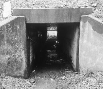
Geese swim just below the Beverly dam. Muskingum River watershed projects were designed to help keep the river from major flooding. The projects help control the amount of water flowing into the river. The dams along the river itself were built in the 1800s and control the minimum depth of the river, making navigation possible. (Photo by Art Smith)
The history of our area is punctuated by floods that have ravished the area from time to time. The worst of them being the flood of 1913 that struck the area 112 years ago this month when the area was hit with eight inches of rain. Marietta, at the confluence of the Ohio and Muskingum rivers frequently gets hit by water from two sides. 1913 was devastating up and down both the Ohio and Muskingum valleys.
The worst natural disaster to ever hit the state, the surging Muskingum River knocked out bridges from Zanesville to Marietta, ruined businesses and killed people unable to get out of the way of the water.
Civic leaders knew something had to be done, the flood of 1932 reinforced it. It was shortly after that work began on the huge public works project that would become the Muskingum Watershed Conservancy District. The goal was to somehow control the flow of water down the Muskingum River. The river drains a huge area of southeastern Ohio, draining 8,051 square miles, and all that water must come past Marietta. The construction of a series of reservoirs would ensure that the water did not all come past here at once.
Work started in 1935 to dam up several of the tributaries that feed into the Muskingum. The reservoirs created behind them would flood thousands of acres and provide recreational opportunities for decades to come.
Dams along tributaries of the Walhonding River at Mohawk, Pleasant Hill, Charles Mill and Mohicanville were planned. Along the Tuscarawas they were to be built at Bolivar, Atwood, Leesville, Beach City, Tappan, Clendening, Dover and Piedmont. Dams at Wills Creek and Senecaville would block creeks east of Zanesville. Dams at Bolivar, Dover, Mohawk, and Mohicanville were designed to only hold back water during high water but would otherwise not block the streams nor form lakes.
The project would initially get funding as a Public Works Project, the influx of more than $22 million would allow construction to get started and put men back to work during the Depression.
The lakes created by the project provide a wealth of recreation opportunities in addition to shielding us from catastrophic flooding.
The 16,000 acres of water also provide habitat for a variety of fish, birds and wildlife.
The lakes include Atwood Lake, Beach City Lake, Charles Mill Lake, Clendening Lake, Leesville Lake, Piedmont Lake, Pleasant Hill, Seneca Lake, Tappan Lake Park, Wills Creek.
The largest of the lakes, Seneca, is just 42 miles up Interstate 77. It also happens to be the easiest for people in Marietta to get to. The 3,550-acre lake provides camping, cabins, hiking and of course boating.
The lake has a 399-horsepower limit, but with that much water there is space for all types of boating. Jet skis, sailboats, pontoons and canoe and kayaks are also very popular. I water skied on the lake when I was much younger and better coordinated than I am now. We also used the lake as a training spot when I rowed crew in the 1970s. The lake is very long and can get choppy when you are far from shore. The wind can also build across the lake, something that was very apparent when I later used the lake to sail on. It is the premier sailing lake in this part of Ohio.
The levels of all the lakes are dropped somewhat each winter. Removing five to eight feet of water from the lakes provides the buffer needed if the state gets heavy runoff over the winter, with the goal being to never experience a flood like 1913 again.
The refilling of the lakes to summer levels normally starts about now.
Art Smith is online manager of the News and Sentinel. He can be reached at asmith@newsandsentinel.com