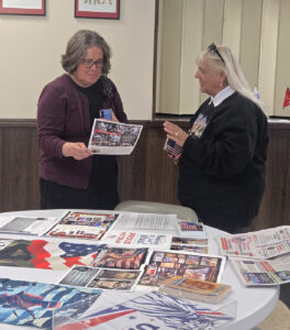
Riverview Cemetery gets map tech upgrade
-
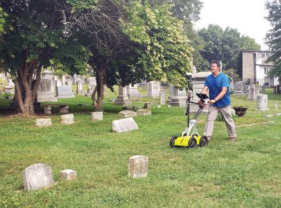
- Ryan North, a near surface geophysicist performs a survey of the cemetery subsurface using a ground penetrating radar. He walked the entire Cemetery in parallel lines to get a full view with proper coordinates. (Photo by Madeline Scarborough)
-
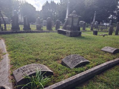
- Some headstones are positioned for symmetry in a plot, when in truth the body is buried a foot or so away. This survey will help determine the accurate location of burial sites, if there are unmarked graves or if the plot is unused. A good example of this is in the Jackson plot next to the weeping widow, where there is a large open space. It is unknown if anyone was buried there alongside the other family members. Descendants of the Jacksons in that plot are still alive and connected with Parkersburg today. Chuck Cox, one of the five cemetery trustees is one of those descendants. (Photo by Madeline Scarborough)
-
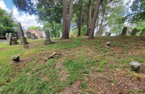
- Stone markers lining out plots can be seen in the cemetery, but it is unclear if they are open spots or if there is an unmarked grave below. The survey will help reveal what areas have been utilized. (Photo by Madeline Scarborough)

Ryan North, a near surface geophysicist performs a survey of the cemetery subsurface using a ground penetrating radar. He walked the entire Cemetery in parallel lines to get a full view with proper coordinates. (Photo by Madeline Scarborough)
PARKERSBURG — The Trustees of Riverview Cemetery are getting a new view of the land with the help of ground penetrating radar (GPR) and unmanned aerial system (UAS) photogrammetric surveys.
“The approach we are taking for this job will allow us to verify burials in locations where there are headstones as well as detect any potential unmarked burials in locations without headstones,” explained Ryan North, a near surface geophysicist with 20 years of experience utilizing a range of geophysical methods.
“We will utilize GPR to detect burials and photogrammetry to generate a high resolution orthophoto of the cemetery over which the GPR data can be plotted,” he explained.
North further explained that GPR is a geophysical method where electromagnetic waves are propagated away from an antenna, into the ground, and at each change in electromagnetic properties some energy is transmitted while some is reflected. The reflected energy is received by another antenna. The data is therefore amplitude versus two-way travel time.
GPR is commonly used in cemetery mapping as it can easily detect current generation coffins but can also detect very old wood coffins that may have collapsed over time.
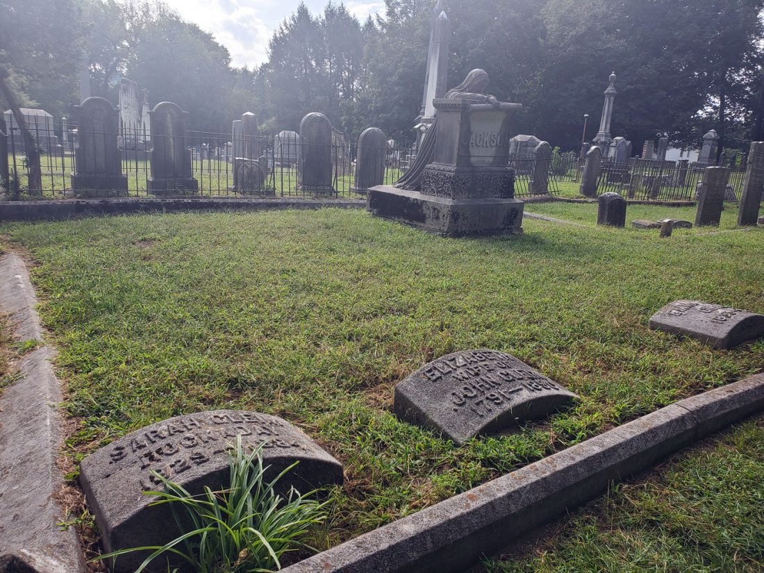
Some headstones are positioned for symmetry in a plot, when in truth the body is buried a foot or so away. This survey will help determine the accurate location of burial sites, if there are unmarked graves or if the plot is unused. A good example of this is in the Jackson plot next to the weeping widow, where there is a large open space. It is unknown if anyone was buried there alongside the other family members. Descendants of the Jacksons in that plot are still alive and connected with Parkersburg today. Chuck Cox, one of the five cemetery trustees is one of those descendants. (Photo by Madeline Scarborough)
According to Chuck Cox, one of the five trustees over the Riverview Cemetery, they are expecting to find many unmarked graves during this survey, and hopefully some empty plots that can help provide some revenue for the cemetery.
Cox said that the cemetery is believed to be the oldest in Parkersburg city limits, with headstones that date back to 1800.
“There is a lot of history here, many if not most of the people buried here are notable in Parkersburg and West Virginia history,” said Cox. “But not a lot of information exists on what is actually below the surface.”
According to Cox, before preservation became important headstones that broke could have been discarded.
“Some headstones have even sunk below the surface over the years,” Cox said. “We just want to know if what we are seeing on the surface matches the subsurface.”
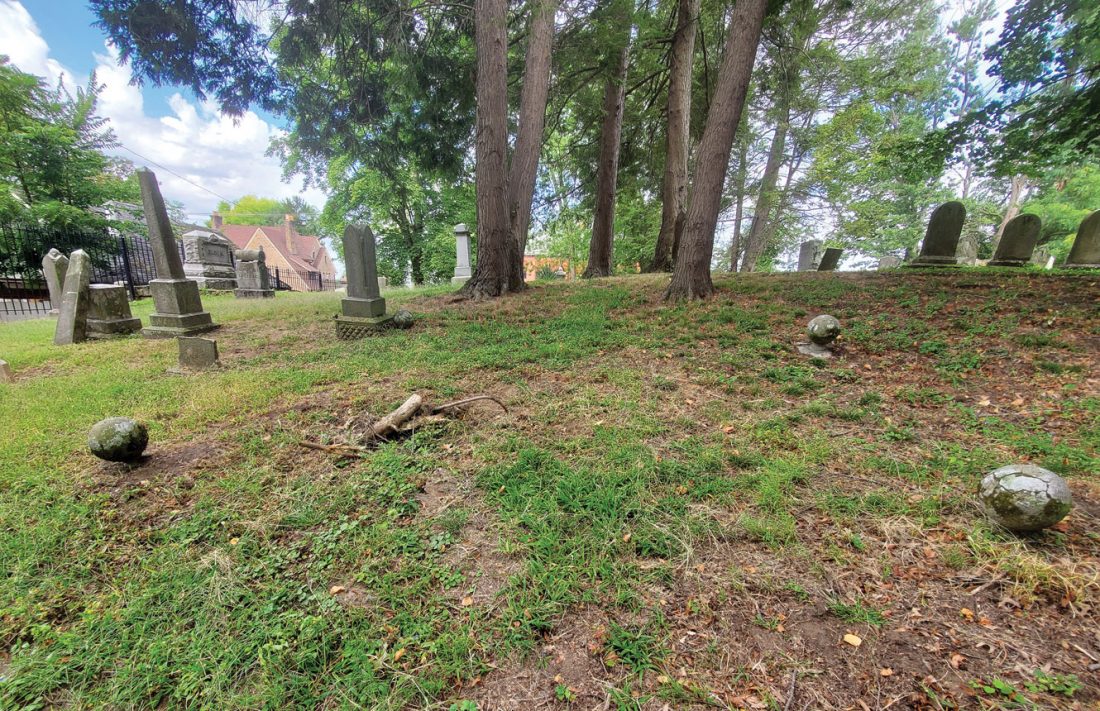
Stone markers lining out plots can be seen in the cemetery, but it is unclear if they are open spots or if there is an unmarked grave below. The survey will help reveal what areas have been utilized. (Photo by Madeline Scarborough)
The GPR data will be processed with GPR-Slice software from the Geophysical Archaeometry Laboratory, which has the ability to import almost any brand of GPR data, process the data, and present it as profiles or time/depth slices.
“The depth slices are used to map the high amplitude anomalies expected from burials,” said North.
North explained that each image will have the GPS coordinate embedded, and that combined with drone footage will give the board a full view of the cemetery above and below.
The results, which can be expected back in a few weeks, will include a map of the site with the potential burial locations indicated.
Local News
LSIC showcase at Parkersburg South highlights student projects, partnerships and hands-on learning across Wood County Schools
Marietta College to celebrate planetarium upgrade

Gov. Morrisey celebrates passage of Rural Health Transformation bill with ceremonial signing

Horton hears a cue! ‘Seussical’ takes the stage at Actors Guild
Marietta native Barbara Smith honors father Master Sgt. William Young Jr.’s legacy through travel, teaching and veterans advocacy