Taking the Trail: New Parkersburg Ohio River Trail offers residents another exercise option
-

- Herb Rake walks along the trail. (Photo by Art Smith)
-
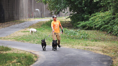
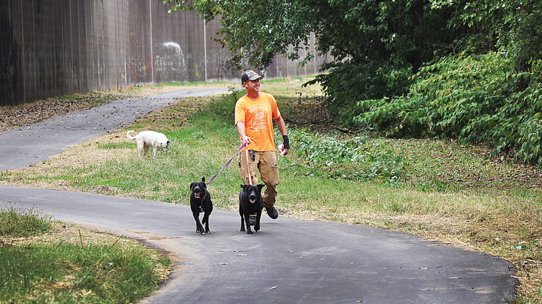
- Joe Wartes walks his three dogs along the river trail. (Photo by Art Smith)
-
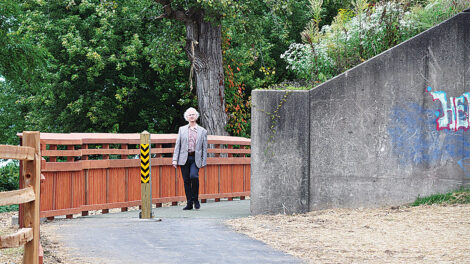
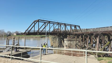
- Bob Herceg crosses the new Pond Run Bridge. (Photo by Art Smith)
-

- Wildflowers bloom between the trail and the Ohio River. (Photo by Art Smith)
-

- The trail-side gap between the two bridges to Belpre. (Photo by Art Smith)
-
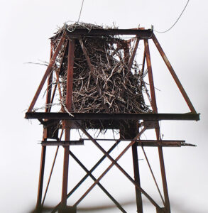
- A bald eagle nest can be seen atop a tower on Neal Island a short distance from the end of the trail. (Photo by Art Smith)
-

- A cartoon drawn on the floodwall.Decades of graffiti is evident along much of the concrete portion of the wall along the trail. (Photo by Art Smith)
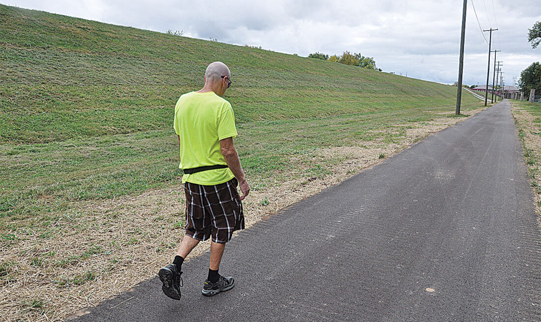
Herb Rake walks along the trail. (Photo by Art Smith)
Nestled between the floodwall and the Ohio River, the recently completed Parkersburg Ohio River Trail is already providing residents with a popular way to run, walk or bike without the hustle of downtown traffic.
Starting at Point Park in Parkersburg, the path travels north to the Parkersburg City limits 2.5 miles away, passing under three bridges and over one creek. The paved path has one road crossing along its length. Users on foot or bicycles can also access the path at an opening at the end of 12th Street and another at the Ohio Valley Rowing Club. Parking is available at the southern end of the trail at Point Park.
When starting at Point Park users will first pass the ongoing mural project on the floodwall. The mural provides an early burst of color on the trail. The floodwall is ever-present along the trail.
Decades of graffiti artists have left their mark along much of the concrete portion of the wall.
The massive project to build the floodwall started in 1946 and took four years to complete. In all, 20,000 linear feet of concrete and steel walls and earthen levees protect the city from flood waters. The nearly 9 million pounds of steel, 63,000 cubic yards of concrete and 600,100 cubic yards of earth also do an incredible job of muffling the noise from the city, providing a peaceful place to enjoy the river.
Joe Wartes walks his three dogs along the river trail. (Photo by Art Smith)
Along the other side of the trail, the mighty Ohio River–openings along the tree-lined riverbank offer views of the river and passing boats.
The path goes around a huge block structure that was part of the old suspension bridge that once crossed the river. The giant structure remains there because the floodwall was built into it. Angie Graham, who works at the Wood County Courthouse, was using this section earlier this week during lunch.
“I have used it every day since they opened it. We have a walking program at work and I use it to try to get 10,000 to 13,000 steps per day,” Graham said.
Users then pass under the two huge bridges that connect downtown Parkersburg to Belpre. The 1980 Parkersburg-Belpre Bridge and its older neighbor, the 1871 Sixth Street Rail Bridge. The trail offers a perspective of trains crossing the Ohio River to serve industrial customers along Ohio 7.
The recently completed Pond Run Bridge gets users over a small tributary that held up the path’s construction for years.

Bob Herceg crosses the new Pond Run Bridge. (Photo by Art Smith)
People such as Parkersburg resident Bob Herceg are already using the trail to get around Parkersburg. “I use it two to three times a week. I live on 13th Street, so it is another way to get to Point Park,” he said. Herceg uses it to walk to his job at WVU Medicine.
Soon the path passes the 12th Street underpass where the street travels under the floodwall. It also provides a secondary spot to get on the trail. “I’ve been coming down here since before it was a trail,” said Joe Wartes of Vienna while walking his dogs. “It’s pretty sweet, I come down and pick up litter. It’s part of my civic duty. It’s pretty rad,” he said of the improvements.
Before the Memorial Bridge, the floodwall transitions from the concrete giant to an earthen levee. This opens the trail up somewhat. When it passes under the Memorial Bridge, users are about one mile from where they started. An open gate is at the club so rowers from Parkersburg High School can get their crew shells to the river. The gate can be used to access or egress the trail.
The building housing the club is an old water treatment plant for the City of Parkersburg. The area past it contains both the city’s active water wells and unused wells. Eight concrete columns that were the old wells line the left side of the path. The trail was constructed along what was a gravel access road for the wells. Signs along the earthen levee warn users of the Parkersburg Police Department Firing Range on the other side of the earthen levee.
Past this point, an old steel tower connects to another tower on Neal Island.

Wildflowers bloom between the trail and the Ohio River. (Photo by Art Smith)
The island tower has a bald eagle nest on top. Deer and fox have also been spotted in this area. Herb Rake, who is the caretaker at the rowing club, walks the section every day and spots animals during his early morning walks. “I think it has a lot of potential,” said Rake while using the trail.
After passing a final closed floodwall gate, the trail ends. A large circle of pavement gives cyclists enough room to turn around.
The Parkersburg city limits are just north of the spot. To extend the trail further will require the City of Vienna to cross the small stream that runs past Grand Central Mall on its way to the river.
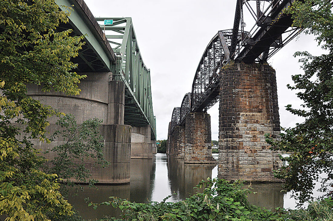
The trail-side gap between the two bridges to Belpre. (Photo by Art Smith)
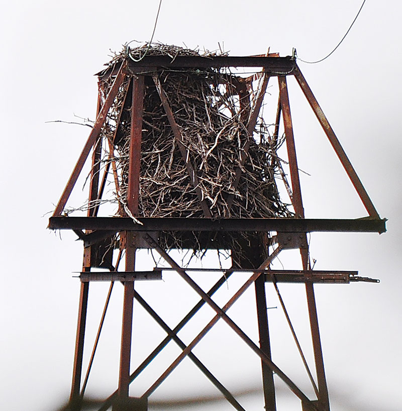
A bald eagle nest can be seen atop a tower on Neal Island a short distance from the end of the trail. (Photo by Art Smith)

A cartoon drawn on the floodwall.Decades of graffiti is evident along much of the concrete portion of the wall along the trail. (Photo by Art Smith)
Local News
Global Shimmy Mob performs for domestic violence awareness
Donor makes $300K gift to Harmar Bridge project

Wood Commission and Union Williams PSD discuss their future
The Castle’s Historic Tour of Homes returns Memorial Day Weekend
MARIETTA - The Historic Tour of Homes presented by The Castle will take place again this year May 23 and 24. The ...
Wood County BOE candidates outline priorities ahead of election
PARKERSBURG – Voters in Wood County will choose from among nine candidates in this year’s Wood County Board of ...
Butler appointed to OhioSE Development Board of Directors
MARIETTA - Ohio Southeast Economic Development (OhioSE) announces the appointment of Craig W. Butler to its Board ...