The Way I See It: Gone without a trace
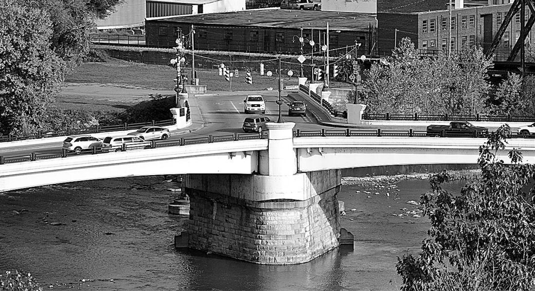
Today travelers in Zanesville cross the Muskingum River on the Y Bridge. The Zane Trace crossed it by ferry at a location nearby. (Photo by Art Smith)
Before there was an interstate – there was a trail.
The next time you are flying down Interstate 70 between Zanesville and Wheeling take a moment to think about the progression the route has taken over the last few centuries. You may be dodging giant 18-wheelers, but earlier travelers had to dodge stumps.
That’s right, stumps. The big block of wood that is still in the ground when you cut down a tree.
Ebenezer Zane traveled across the Appalachian Mountains in 1769 and began clearing land to farm near the confluence of Wheeling Creek and the Ohio River. The area later became Fort Henry, and Zane became Col. Ebenezer Zane. Following the war, he was elected several times to the Virginia House of Delegates.
In 1796 he took on another challenge: road building. Congress agreed to build a “road” from Wheeling to Maysville, Ky. In exchange he would be granted land where the “road” crossed the Muskingum, Hocking and Scioto rivers.
With help of others, including his brother Jonathan Zane, his son-in-law John McIntire, and a native American guide named Tomopomehala, Zane set out to connect Wheeling with the west via Chillicothe, the only existing community along the chosen route. Using the Mingo and Moxahala trails as a starting point, the group of men hacked their way through the old growth forests of southern Ohio.
The Zane Trace was the first road across Ohio, but to call it a road is generous. The group cut down the trees, but the stumps remained. The intention was for a person on a horse to be able to cross the rugged route to the west. It was not yet wagon-ready. Ferries operated to get travelers across the larger rivers with the horses fording across the smaller ones along the route. The 228-mile trip from Wheeling to Maysville took 5 days.
After Ohio became a state in 1803, a transportation tax funded the removal of thousands of stumps with laborers widening the road so wagons could get through.
Between 1825 and 1830 the Zanesville to Wheeling portion was rebuilt again to become part of the National Road. The 620-mile road was the first road in the country built with federal funds. The suspension bridge in Wheeling was added in 1849.
The National Road eventually became U.S. 40 through eastern Ohio. Travel the road today and you are likely to spot the stone mile makers along the roadside. It runs near Interstate 70 for much of its route
The sixth and final version of the route, Interstate 70 now carries thousands of vehicles per day between Wheeling and Zanesville, a city named in honor of Ebenezer Zane who first blazed the trail between the two cities more than two centuries ago. I-70 reaches 2,172 miles from Baltimore to central Utah.
From the Zane Trace to the first improvement, to the conversion to the national road and creation of U.S. 40, to final construction of Interstate 70 — Each time the road has been rebuilt it has been made flatter and straighter than the version before it.
The next time you are fighting traffic on Interstate 70 on your way to Columbus, remember, it could be worse, you could be dodging stumps.
Art Smith is online manager of The Marietta Times and the Parkersburg News and Sentinel. He can be reached at asmith@mariettatimes.com.
Local columns
Look Back: ‘Man-Bird’ lands in Parkersburg

Reporter’s Notebook: Lions and lambs of the Senate

The Crochet Lady: Widen your scale and brave a new project with this dragon-themed scarf

Cracking the Code: Real power is the ability to lead

Editor’s Note: Adopting a shelter animal
