Heavy rainfall, tornado fears flood parts of Mid-Ohio Valley

Photo by Evan Bevins A truck drives through water across Old St. Marys Pike near Newbanks Road just outside Parkersburg Wednesday afternoon.
-

- Photo by Evan Bevins A truck drives through water across Old St. Marys Pike near Newbanks Road just outside Parkersburg Wednesday afternoon.
-
- Photo by Brett Dunlap Heavy rains caused flash flooding in areas, including across Core Road just off 36th Street in Parkersburg.
-

- Photo by Evan Bevins A car drives through water across Old St. Marys Pike near Newbanks Road just outside Parkersburg Wednesday afternoon.
The Parkersburg area had around 2.14 inches of rainfall throughout the day, said Andrew Beavers, meteorologist with the National Weather Service in Charleston.
The first wave of rain hit the area around 7 a.m. in which around 1.81 inches fell and then another 0.33 inch fell by 1 p.m.
“Ordinarily, we don’t see this kind of weather until late spring or early summer,” Beavers said.
With the warmer air, there is more build up for these kinds of weather systems to form.
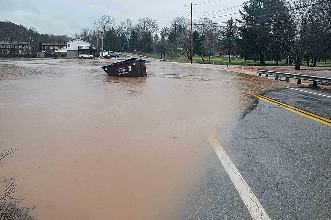
Photo by Brett Dunlap Heavy rains caused flash flooding in areas, including across Core Road just off 36th Street in Parkersburg.
“We are seeing these things a little earlier,” Beavers said. “However, we can really see this kind of weather anytime of the year.”
Early weather reports stated conditions were in place for a possible tornado to form and touch down in the Parkersburg area on Wednesday.
People at local schools and other locations sheltered in place while the skies turned dark around 10 a.m. Wednesday.
The weather service did not have confirmation of tornados touching down anywhere. “We have crews out looking at that,” Beavers said.
Throughout the area, there were reports of flash flooding, power outages and tree limbs down.
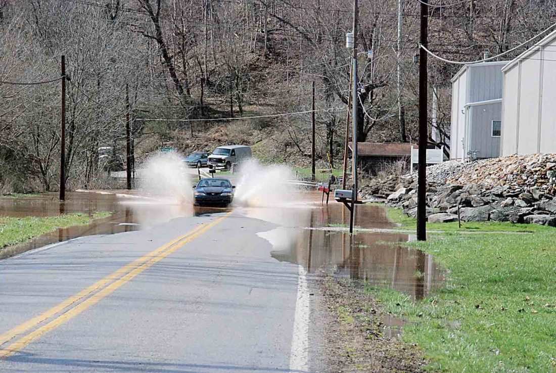
Photo by Evan Bevins A car drives through water across Old St. Marys Pike near Newbanks Road just outside Parkersburg Wednesday afternoon.
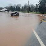
The Wood County 911 Center reported flooded roadways Wednesday around 8 a.m. along the 3800 block of Parkview Drive, Carpenter Run Road at Dee Street, 2100 block of North Oak Grove Road, the 1000 block of Walker Road where a mudslide occurred, Woodland Drive at Valley View Drive, the 8800 block of DuPont Road near the Little General Store, Waverly Road at Fenton Lane near Carr Concrete, Orem Road at Wadesville Road, the 3600 block of Lee Creek Road, Core Road at 36th Street, Old St. Marys Pike at Newbanks Road and Old St. Marys Pike at Johnson Creek Road.
No flooding was reported in Spencer, but schools were let out at noon Wednesday, Spencer Mayor Terry Williams said.
“The water is still in the creek banks,” he said at around 2 p.m. Wednesday. “It was not as bad as it could have been. We were lucky.”
Williams thought the Walton area was harder hit with rain, wind and hail.
The Roane County 911 Center reported it had trees down with powerlines and powerlines down throughout the county Wednesday afternoon.
Walter Smittle, Jackson County Emergency Services director, said the situation was returning to normal by Wednesday afternoon. The county had minor flooding and trees on powerlines.
“The water was receding,” Smittle said Wednesday afternoon.
In Ravenswood, Mayor Josh Miller said they saw wind damage. When it appeared a tornado might be coming through the area, people were sheltering in place at schools and at the fire department.
“It was better to be safe than sorry,” Miller said. “Overall, we were very lucky. Everyone knew what to do.”
The strong winds left debris along Hemlock Road and some other areas, Miller said.
Power outages were reported throughout the area Wednesday.
Todd Meyers, spokesman for MonPower and First Energy, said they were well aware of the weather that was coming into the area Wednesday and were preparing to deal with it Tuesday night.
By 11:30 a.m., Wood County had 1,020 customers without power, 1,762 in Roane County, 140 in Wirt County and 900 in Jackson County.
By 4 p.m., Wood County had around 224 customers without power, 364 in Roane, 190 in Wirt and 70 in Jackson.
Although the majority of outages in this area are expected to be fixed, some could take the next few days to be completed as MonPower has people coming into West Virginia from other regions to help with the power restoration.
A line between Belleville and Washington was brought down by a falling tree, which caused problems for people in that area. Crews were on the scene working to restore power Wednesday.
With technology, people can assess what work crews need through Smartphone pictures, Meyers said. People can alert crews to a situation, send pictures and crews can stock the proper equipment and tools to deal with the problem more effectively when they arrive, he said.
“It helps restore power quicker,” Meyers said.
Severe thunderstorms left areas of Washington County with high water and road closures on Wednesday.
“This is nothing compared to what we have seen before but some roads are still going to be a problem for people coming home from work,” said Janet Kidd, resident and treasurer for the Village of Lower Salem, on Wednesday. “Duck Creek is always one of the first to flood.”
Fort Frye Local Schools had an early dismissal Wednesday afternoon because of the high water throughout parts of the district.
“Duck Creek will probably be over (Ohio) 821 and that’s why they decided to let the kids out early,” said Lloyd Booth, board member for Fort Frye Local Schools. “The buses still had to run and we wouldn’t want to prevent that from happening from high waters.”
During one of the storms Wednesday morning, the Warren Local and Marietta City school districts went into tornado safety drill locations to protect their students from strong winds. Schools in Williamstown also had children go to shelters within the buildings.
Waterford Elementary School first-grade teacher Danette Schaad said the storm scared her students.
“We had to shut the curtains just to keep the kids’ attention away from the storm,” she said.
According to a report by the Washington County Sheriff’s Office at 4 p.m., 12 roads had been closed and five roads were considered restricted due to high water. Lowell Loop Road, Ohio 821 at mile marker 20, Buells Run Road at mile marker 13, Stanleyville Narrows at Nichols Road, Rainbow Road at Muskingum River Road, and Caywood Road south of Stanleyville Road were all closed on Wednesday. Three parts of Ohio 26 were also closed, including at the Rinard Covered Bridge, at mile marker 23 and at mile marker 25.
Restricted roads in Washington County, according to the Ohio Department of Transportation, included areas on Ohio 260 near the Monroe County line, areas between Lower Salem and the Noble County line, areas between Ohio 555 and Ohio 792, areas between Lower Salem and the junction to Ohio 530, and between Macksburg and the Noble County line.
A flash flood warning was in effect in Washington County until 2 p.m. Wednesday.
(Reporter Peyton Neely contributed to this story.)
Local News

Trump says Pam Bondi, a loyalist who oversaw Justice Department upheaval, is out as attorney general

Rotating exhibit space aims to boost learning at Discovery World

No Joke: Personal income tax collections down in March but W.Va. revenues remain in black

Capito speaks at final day of W.Va. Coal Association Mining Symposium
Multiple fire departments respond to two fires Tuesday
PARKERSBURG – Multiple local fire departments responded to a brush fire and structure fire Tuesday evening. The ...
Parkersburg mayor offers way for petitioners to remove signatures
PARKERSBURG – As a committee seeking to repeal or place on the ballot an ordinance authorizing a trash service ...